


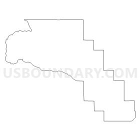
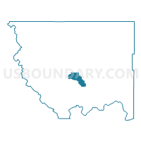
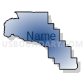
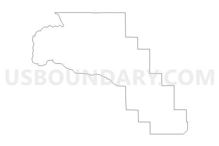
Boston Voting District, Okanogan County, Washington
About
Outline
Summary
| Unique Area Identifier | 687802 |
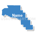
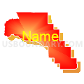
| Name | Boston Voting District |
| County | Okanogan County |
| State | Washington |
| Area (square miles) | 57.16 |
| Land Area (square miles) | 56.87 |
| Water Area (square miles) | 0.28 |
| % of Land Area | 99.50 |
| % of Water Area | 0.50 |
| Latitude of the Internal Point | 48.38434510 |
| Longtitude of the Internal Point | -119.75772300 |
Maps


Graphs
Select a template below for downloading or customizing gragh for Boston Voting District, Okanogan County, Washington


Neighbors
Neighoring Voting District (by Name) Neighboring Voting District on the Map
- Alma Voting District, Okanogan County, WA
- Beaver Creek Voting District, Okanogan County, WA
- Chiliwist Voting District, Okanogan County, WA
- Eastside Voting District, Okanogan County, WA
- Fletcher Voting District, Okanogan County, WA
- Hudson Voting District, Okanogan County, WA
- Malott Voting District, Okanogan County, WA
- Mock Voting District, Okanogan County, WA
- North Malott Voting District, Okanogan County, WA
- Okanogan Rural Voting District, Okanogan County, WA
- Spring Coulee Voting District, Okanogan County, WA
- Winthrop Rural Voting District, Okanogan County, WA
Top 10 Neighboring County Subdivision (by Population) Neighboring County Subdivision on the Map
- Colville Reservation CCD, Okanogan County, WA (5,954)
- Methow Valley CCD, Okanogan County, WA (5,522)
- Brewster-Wakefield CCD, Okanogan County, WA (4,930)
- Okanogan CCD, Okanogan County, WA (4,286)
- Conconully-Riverside CCD, Okanogan County, WA (2,321)
Top 10 Neighboring Unified School District (by Population) Neighboring Unified School District on the Map
- Omak School District, WA (10,481)
- Okanogan School District, WA (5,637)
- Methow Valley School District, WA (5,230)
Top 10 Neighboring State Legislative District Lower Chamber (by Population) Neighboring State Legislative District Lower Chamber on the Map
Top 10 Neighboring State Legislative District Upper Chamber (by Population) Neighboring State Legislative District Upper Chamber on the Map
Top 10 Neighboring 111th Congressional District (by Population) Neighboring 111th Congressional District on the Map
Top 10 Neighboring Census Tract (by Population) Neighboring Census Tract on the Map
- Census Tract 9708, Okanogan County, WA (4,930)
- Census Tract 9707, Okanogan County, WA (4,286)
- Census Tract 9710, Okanogan County, WA (3,670)
- Census Tract 9402, Okanogan County, WA (3,129)
- Census Tract 9705, Okanogan County, WA (2,321)